The legal register of public rights of way in England and Wales is known as the Definitive Map. In York this Map is maintained by the City of York Council (COYC). The definitive map for York shows public bridleways (which are open to cyclists) and public footpaths (which are not even if cyclists have dismounted). This will surprise some who habitually ride along public footpaths as an assumed right; they are for foot traffic only.
Bishopthorpe’s parochial parish council has asked COYC for two more footpaths to be added to the Definitive Map. One is the St. Andrews’ Trust riverside path between Ferry and Chantry Lanes, the other is a towpath between Ferry Lane and Naburn.
Having considered the legal evidence for each claim, COYC has dismissed the first as false but agrees that a towpath exists as a public right of way all along the riverbank from Ferry Lane to Naburn. This means that you have no legal right to cross the Trust’s land anywhere, including along our riverside path. This is a permissive footpath only that we allow the public to use at our discretion and may close at any time. You have no public right of access to it but we have no plans to close it providing people behave responsibly while on it and cyclists do not use it.
The evidence used by COYC to investigate and substantiate the parish council’s claim that a towpath exists to Naburn is mainly the Ordnance Survey. Its maps show that one has existed here since at least 1850. Its legal route is along the riverbank, not along the modern vehicular road constructed away from the riverbank by the current landowner.

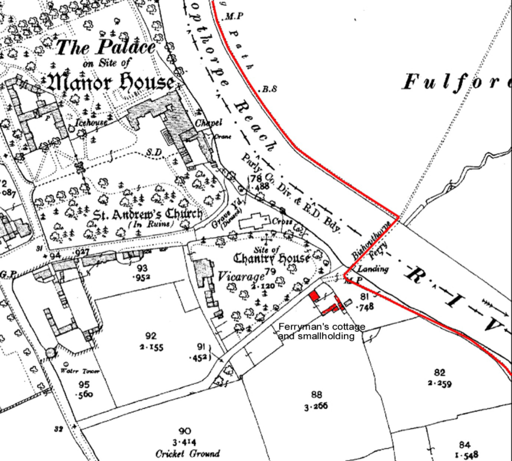
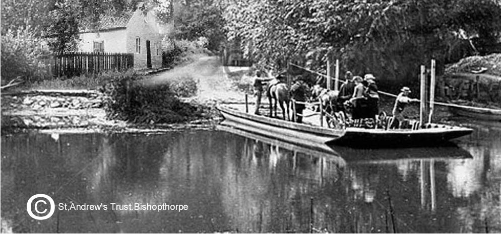
As the name implies, towpaths were used by horses (and people) to tow river craft upstream and many of our prettiest public rights of way in the U.K are of this type. Their main attractions are the open views of river or canal. At the moment the only place in Bishopthorpe where you are able to enjoy this experience is along our riverside path. This is why it is such a valued local amenity but not a reason for it to be either a towpath or a public right of way. It never has been one as the old O.S. map below shows. The Bishopthorpe towpath (red line) was diverted to the other side of the river by the Bishopthorpe Ferry before it reached our land. This is where the barge horses were ferried across because Bishopthorpe Palace and our old churchyard blocked the route to York on our side.

We have added the Georgian home of the ferryman who operated it and his small-holding to the map for reference. The outbuildings are where he kept his pigs and chickens to feed his family. Being a ferryman was not a well-paid job despite providing the only easy way for the residents of Bishopthorpe to get to Fulford Ings.

This attractive page from the long history of Bishopthorpe was ripped out by developers earlier this year and only the name Ferry Lane now remains as a sort of memento more. Even the old fruit trees on his little parcel of rented land (from the Archbishop) have been destroyed. This is where he grew his plums and apples.
We built our riverside path out into the river with substantial funding from the National Heritage Memorial Fund (NHMF) 20 years ago to serve a specific purpose. This was to join two parts of the Bishopthorpe Conservation Area together that were previously inaccessible to pedestrians, the main one based on Chantry Lane and the secondary one on Ferry Lane. The only reason the latter was considered to be an “area of special architectural and historic interest” was because Ferry Cottage and its historic site were in it. Now they are not it has lost its claim to be a conservation area and we have lost the reason for the existence of our riverside path. Technically it is now open for the NHLF to recover its money because that purpose is no longer being served, but not from the Trust. We gave formal warning to COYC before it granted Demolition Consent. If the NHMF does ever seek to recover its funding leading to the closure of our riverside path we shall direct its claim where it belongs to COYC, the developers, and the parish council who supported the loss of this single asset from the Ferry Lane conservation area.