Our Conservation Management Plan (CMP) and application for Conservation Area Consents explained.

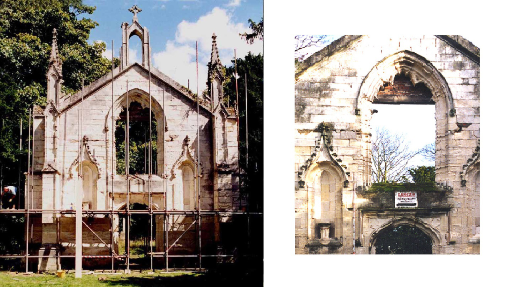
20 years ago we intervened to stop the demolition of the west front of St. Andrew’s Old Church. Its window tracery had already been removed and scaffolding was being erected to take down the rest. Listed Building Consent to erase this landmark from Bishopthorpe was granted to its owners, the Church Commissioners, by the then local planning authority, Selby District Council.
It was said by them to be too dangerous and dilapidated to restore.

In 1999 we took freehold possession of this part of this old archiepiscopal estate and its eroding riverbanks, and over the next 3 years restored them with help from the National Heritage Memorial Fund and other heritage bodies.
As a result you now enjoy free access to the heritage site we established on this former private land and to its only open riverscape left in Bishopthorpe. Otherwise your route to the river is the busy unattractive road to an over-exploited campsite that Ferry Lane has become. Five years ago it was still a quiet green lane through a pleasant part of the Bishopthorpe Conservation Area, so we fully understand why our riverside path is now regarded by so many as an indispensable asset.
This is one reason for producing our new Conservation Management Plan (CMP) which sets out all the measures we need to take to ensure that you and your children continue to enjoy the same benefits for the next 20 years and beyond.
In 1999 our earlier CMP attracted the substantial funding from the National Heritage Memorial Fund that enabled us to make these gifts to you. Our latest CMP is designed for the same purpose so that we can still continue to make them in future.
But first we need planning consent from the City of York Council to implement the first parts of our CMP, namely our flood alleviation scheme and solving the problem of the collapsing St. Andrew’s cross.
We have combined them in one application for consents under the 1990 Planning (Listed Buildings and Conservation Areas) Act because they will each affect the “character and appearance” of this area “of special architectural and historic interest” in different ways. This is the statutory definition of a Conservation Area first introduced by the Civic Amenities Act 1967. Its precepts and wording have not changed in the interim.
The emphasis is still very much on architectural content and historic character, which the definition goes on to say are “desirable to preserve (i.e. keep/retain) and enhance ( i.e emphasize / increase/bring out)”.
The prevailing character of our heritage site is entirely historic and it has a dominant architectural centerpiece that we have been at pains to preserve unaltered for the last 20 years. We have no plans to alter it now.
But the pre-emptive action we are planning to preserve the St. Andrew’s cross, by lowering it down gently in one piece before it falls and breaks apart, will remove it temporarily from the setting of this monument and reduce its historic content for a time. Our primary objective is to discover the cause of the sudden instability so that it can be rectified and the cross re- erected on firmer foundations. And, yes, this will also mean excavating the grave of an Archbishop of York using modern archaeological technics and protocols for the first time.
The principal change our flood alleviation scheme will make to the appearance of our site will be the enhancement of its historic character , in one of two ways.
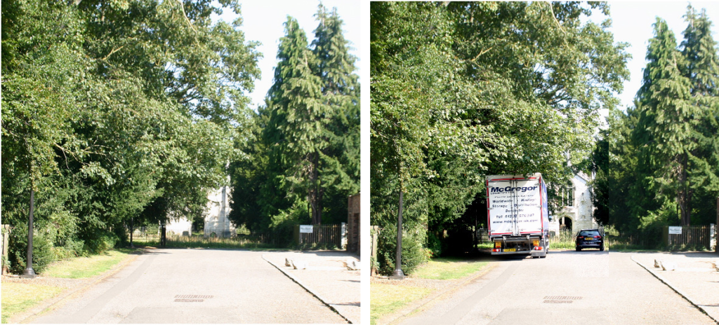
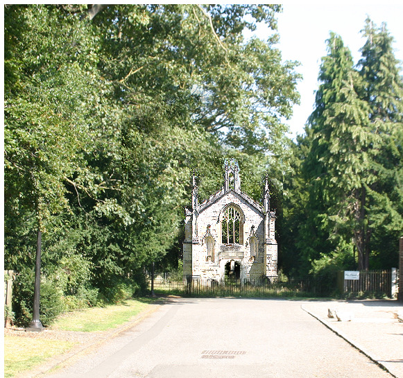
Firstly, the compelling axial view of our architectural centrepiece along Chantry Lane is currently devalued by too much tree cover, parked vehicles, and litter strewn by their owners.

Our scheme removes these obstructions and reinstates this all-important axial relationship between our heritage site and its connection with the rest of the Conservation Area like this:


Secondly, these displaced headstones, 19 of them, are stacked along our southern boundary waiting to resume their proper places in our churchyard. We already have consent under the 1990 Act to do this.
The problem is that only the top two-thirds show above ground. The rest is buried and needs about a metre of compacted soil to stand in. We don’t have that depth at the moment because the whole area in front of the façade of St. Andrew’s Old Church was scraped level in the 1990s to form a construction site to install a large new drainage culvert through it from Chantry Lane to the river.
This is why the entrance to our site is rather low, flat, and featureless, lacking the character of an ancient churchyard in which multiple internments over a long period of time have raised ground levels. This characteristic feature is missing from our site.
We plan to reinstate it as an enhancement measure to serve three purposes for the price of one :
- provide a low flood-resistant embankment
- provide the depth of soil we need to restore our displaced monuments and
- thereby emphasise the historic character of our heritage site in accordance with the precepts of the 1967 Act.
So what happens next?
Our planning application was validated by COYC on 8/8/2019 so it has until 3/10/2019 to come to a decision within the statutory determination period. Public consultations orchestrated by COYC are now taking place with particular reference to adjoining landowners, other community representatives, and of course the Environment Agency.
Obtaining statutory planning consent for our public works is an essential first step to then launching our fund-raising campaign. Almost all sponsors of heritage schemes in the U.K. insist on grant applicants providing proof of their expertise and a Consent Notice from their local planning authority. We are no exception despite being both a registered Environmental Body (E.B.) as well as a conservation trust answerable to the Charity Commissioners. As such we are as much a public body as the council itself but the common factor here is whether or not our proposals comply with the precepts of the 1967 and 1990 planning Acts. That is the sole matter for determination at present, and no other. You now have the statutory definition of a Conservation Area before you. Do our proposals comply? That is the only question COYC is required to answer by this application.